High-Definition 3D Laser Scanning Services

We capture the physical world with sub-millimeter accuracy using state-of-the-art terrestrial LiDAR technology. Stop relying on outdated 2D plans, manual tape measures, and fragmented surveying data. Our integrated spatial workflows bundle surface point clouds with subsurface utility mapping to completely de-risk your AEC, mining, and industrial projects.

3D Laser Scanning Service

What is High-Precision 3D Laser Scanning?

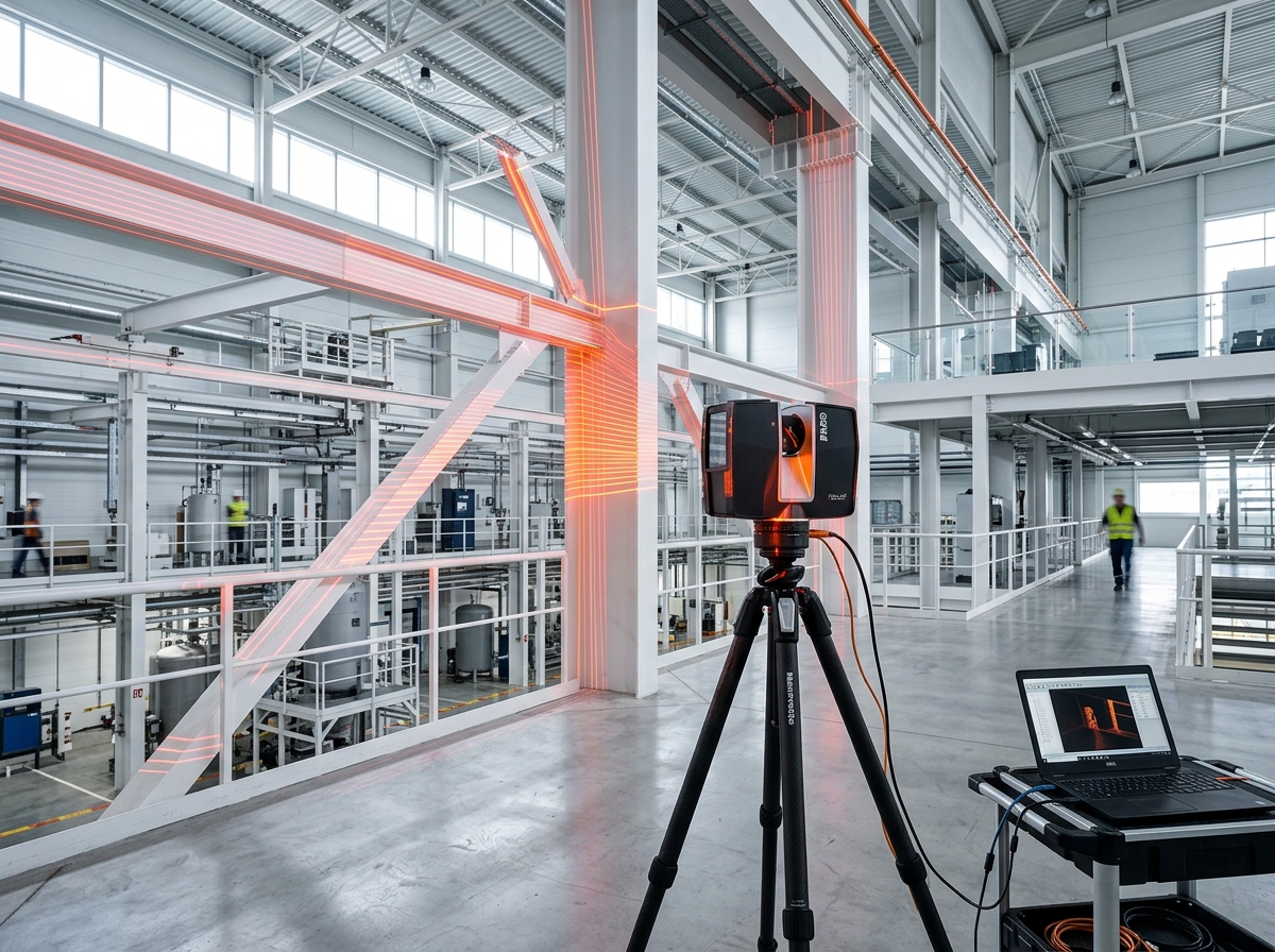
3D laser scanning (LiDAR) is a highly accurate spatial data capture method that utilizes laser beams to map physical environments. By capturing up to 2 million data points per second, it creates a millimeter-precise digital twin—known as a point cloud—of buildings, industrial plants, and topography. This eliminates manual measurement errors and provides engineers with an exact 3D representation for clash detection, reverse engineering, and BIM modeling.

Exact Metrics, Tolerances & Deliverables

We operate at the cutting edge of spatial data capture, utilizing industry-leading hardware and software to ensure uncompromising data integrity.

Hardware & Accuracy Specs

We deploy advanced terrestrial scanners that guarantee sub-millimeter tolerances. Whether scanning intricate mechanical parts or expansive architectural structures, our hardware captures up to 2,000,000 points per second at a range of up to 300 meters.

Backend Processing

Raw data is rigorously processed using specialized software like Maptek PointStudio, Deswik, and Autodesk ReCap. This ensures strict registration matrices and zero point-cloud drift across massive datasets.

Output Formats

We deliver universal, indexed point cloud formats including .rcp, .e57, .las, and .xyz. These integrate seamlessly into your existing CAD/BIM environments like AutoCAD, Revit, Civil 3D, and Navisworks.

The Technical Process: From Site Capture to Unified BIM

Phase 1: Site Reconnaissance & Control Establishment

Our surveyors begin by establishing local coordinate systems and deploying checkerboard and spherical targets. This guarantees precise scan registration over long distances.

Phase 2: Surface LiDAR Capture

High-speed, high-density point cloud generation of all visible above-ground structures. We use HDR photography overlaid on the LiDAR to create colorized, photorealistic data sets.

Phase 3: Subsurface Utility Mapping (GPR)

Integrating Ground Penetrating Radar to detect underground utilities, voids, and structural rebar, ensuring no hidden surprises during excavation.

Phase 4: Point Cloud Registration

Stitching hundreds of individual scans together into a single, cohesive 3D dataset in the office. We maintain survey-grade accuracy by tying all data into the national grid.

Phase 5: Deliverable Extraction

Generating actionable insights, 2D CAD layouts, or LOD 300-500 Revit models directly from the raw point cloud data.

Request an Instant Estimate

Real-World Scenarios: De-Risking South African Projects

Mining & Underground

Safe, rapid volumetric analysis and shaft mapping in hazardous environments across the Reef, capturing data without halting active production lines.

Commercial AEC

Identifying critical clashes in complex MEP (Mechanical, Electrical, and Plumbing) routing before construction begins, saving millions in rework on high-rise developments in Sandton and Cape Town.

Industrial Plants

Accurate 'as-built' capturing of complex pipework and pressure vessels for reverse engineering and maintenance retrofits in Durban's industrial hubs.

Frequently Asked Questions (South Africa)

What file formats will I receive, and are they compatible with Revit or AutoCAD?

We deliver registered point cloud data in .RCP, .E57, and .LAS formats (100% compatible with Autodesk Revit, AutoCAD, Navisworks, and ArchiCAD), as well as native 3D .RVT BIM models (LOD 200–500) and 2D/3D .DWG CAD drawings ready for immediate design workflows.

What level of accuracy can 3D laser scanning achieve on site?

Our high-definition terrestrial LiDAR scanners achieve sub-millimeter to ±2mm spatial accuracy. This millimeter precision allows engineering and architectural teams in South Africa to pre-detect clashes and eliminate costly site rework before fabrication or construction begins.

What is the difference between a Point Cloud and a Scan-to-BIM model?

A Point Cloud is a raw 3D digital measurement map composed of millions of laser points (.RCP/.E57). Scan-to-BIM converts that raw point cloud into an intelligent, parametric 3D Revit model (.RVT) containing smart building objects like structural beams, walls, pipes, and MEP systems for architectural design and facility management.

How long does a 3D scanning survey and modeling project take in South Africa?

Our localized survey teams in South Africa can mobilize within 24 to 48 hours of project approval. On-site scanning is up to 75% faster than manual surveying (typically 1 to 2 days on site), and registered point clouds or 3D BIM models are delivered within 3 to 5 business days.

Can 3D laser scanning be conducted on active industrial or mining sites without downtime?

Yes. Non-contact terrestrial laser scanning operates safely from a distance without touching equipment or disrupting plant operations. Our field surveyors hold safety certifications and medical clearances to operate on active construction sites, chemical plants, and underground mines across South Africa.

How are 3D laser scanning project costs calculated?

Pricing is based on site square footage/acreage, spatial complexity (e.g., commercial building vs. complex industrial MEP plant), and requested deliverable type (raw point cloud vs. LOD 300–500 BIM model). You can request an instant indicative cost estimate via our online estimator tool.

Ready to Start Your 3D Laser Scanning Project?

Get an instant price estimate for millimeter-accurate point cloud data, Scan-to-BIM Revit modeling, and 3D reality capture across South Africa.

Request an Instant Estimate Call a Technical Expert
Have an RFP or floor plans? Email us directly.

Trusted by Top AEC & Mining Firms Across South Africa

Anglo American
Eskom
Omnia
Wilmar
BMSA
FRYS Metal
Santasalo
Anglo American
Eskom
Omnia
Wilmar
BMSA
FRYS Metal
Santasalo