Parametric CAD Modeling
We deliver fully editable, feature-based solid models. Our engineers reconstruct the part using logical CAD operations (extrusions, sweeps, lofts) rather than automated surface wrapping.
High-fidelity industrial 3D scanning and reverse engineering. We convert physical components into exact parametric 3D CAD models, allowing you to manufacture, modify, or archive critical assets with zero geometric variance.
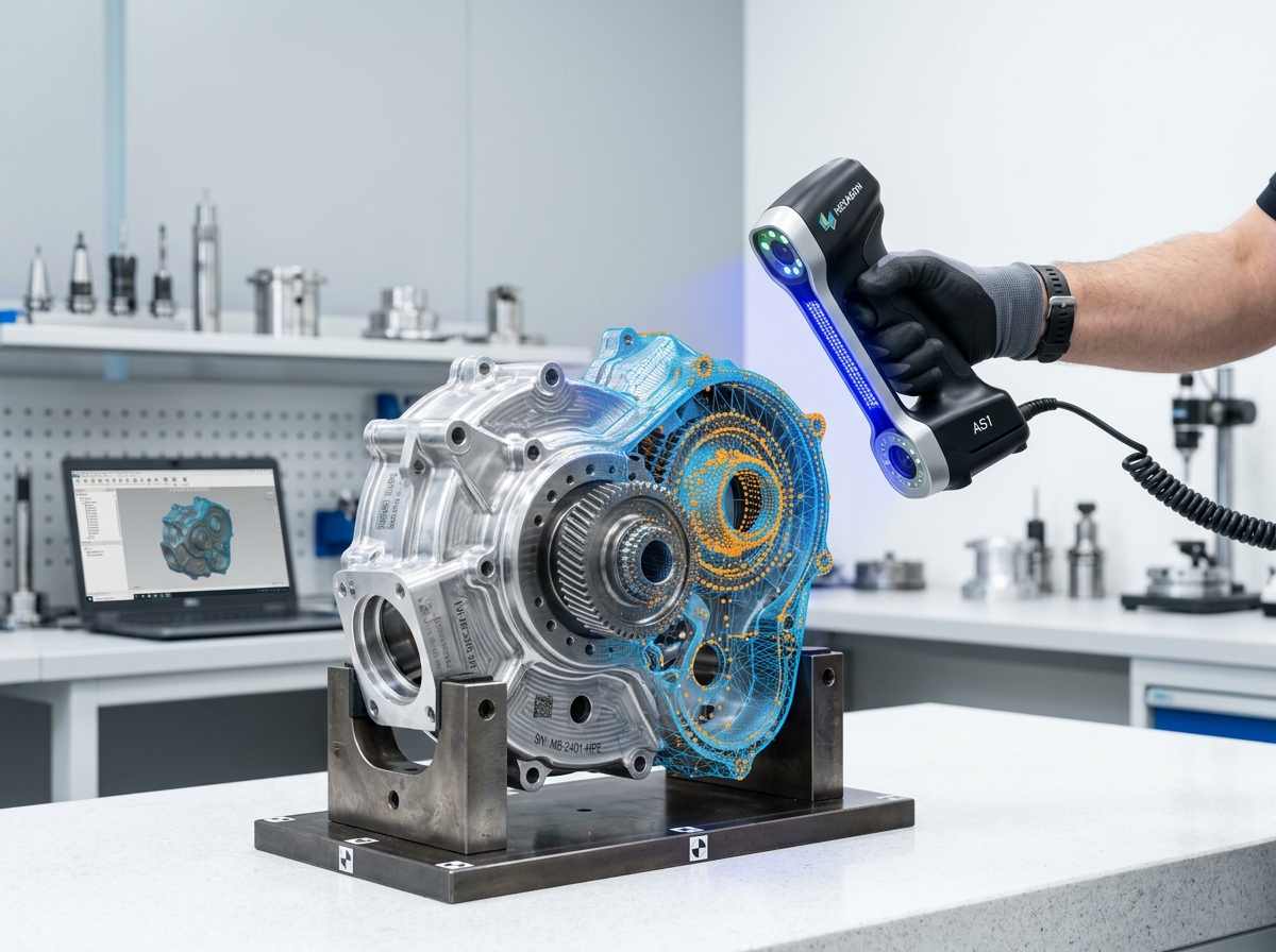
3D Reverse Engineering is the process of extracting design intent and dimensional data from a physical part to create a parametric 3D CAD model. When OEM blueprints are lost, parts are obsolete, or custom modifications are required, we utilize ultra-precise metrology-grade 3D scanners to digitize the component. This raw scan data is then rebuilt in software like SolidWorks or Geomagic Design X to create a perfect, manufacturable CAD file ready for CNC machining, 3D printing, or FEA analysis.
We do not just hand you a "dumb" STL mesh. We provide true feature-based solid models designed for immediate industrial application.
We deliver fully editable, feature-based solid models. Our engineers reconstruct the part using logical CAD operations (extrusions, sweeps, lofts) rather than automated surface wrapping.
Don't just recreate—improve. Once digitized, we can modify the geometry to eliminate weak points, adjust for shrinkage in injection molding, or adapt the part for modern CNC tolerances.
We output native files for SolidWorks, Inventor, and AutoCAD, as well as universal neutral formats including STEP (.stp), IGES (.igs), and Parasolid (.x_t).
Using structured light or portable CMM laser scanners, we capture the physical part at an accuracy of up to 0.02mm, generating a highly dense polygon mesh.
The raw mesh is cleaned, healed, and aligned to a global coordinate system matching the original manufacturing datum planes.
Using Geomagic Design X, we analyze the mesh to determine the original design intent, ignoring physical defects like dents, wear, or manufacturing flaws present on the scanned part.
Our mechanical engineers build a pristine, feature-based 3D model over the extracted reference geometry, ensuring perfect tangency and manufacturing-ready tolerances.
The final CAD solid is cross-referenced against the original scan data via a 3D heat map to guarantee accuracy before exporting to STEP/IGES formats.
Re-manufacturing broken cast-iron gears for mining excavators in the Northern Cape when OEM replacement parts have lead times of over 6 months.
Digitizing complex aerodynamic surfaces and interior cabins for aftermarket automotive parts manufacturing and custom aerodynamic retrofits.
Scanning hand-sculpted clay models or physical prototypes and converting them into pristine CAD geometry for mass production tooling.
We deliver registered point cloud data in .RCP, .E57, and .LAS formats (100% compatible with Autodesk Revit, AutoCAD, Navisworks, and ArchiCAD), as well as native 3D .RVT BIM models (LOD 200–500) and 2D/3D .DWG CAD drawings ready for immediate design workflows.
Our high-definition terrestrial LiDAR scanners achieve sub-millimeter to ±2mm spatial accuracy. This millimeter precision allows engineering and architectural teams in South Africa to pre-detect clashes and eliminate costly site rework before fabrication or construction begins.
A Point Cloud is a raw 3D digital measurement map composed of millions of laser points (.RCP/.E57). Scan-to-BIM converts that raw point cloud into an intelligent, parametric 3D Revit model (.RVT) containing smart building objects like structural beams, walls, pipes, and MEP systems for architectural design and facility management.
Our localized survey teams in South Africa can mobilize within 24 to 48 hours of project approval. On-site scanning is up to 75% faster than manual surveying (typically 1 to 2 days on site), and registered point clouds or 3D BIM models are delivered within 3 to 5 business days.
Yes. Non-contact terrestrial laser scanning operates safely from a distance without touching equipment or disrupting plant operations. Our field surveyors hold safety certifications and medical clearances to operate on active construction sites, chemical plants, and underground mines across South Africa.
Pricing is based on site square footage/acreage, spatial complexity (e.g., commercial building vs. complex industrial MEP plant), and requested deliverable type (raw point cloud vs. LOD 300–500 BIM model). You can request an instant indicative cost estimate via our online estimator tool.
Get an instant price estimate for millimeter-accurate point cloud data, Scan-to-BIM Revit modeling, and 3D reality capture across South Africa.
Trusted by Top AEC & Mining Firms Across South Africa